|
|

About Google Maps
To map the Earth as closely as possible, is a need almost as old as humanity itself (see cartography on Wikipedia).
The technical developments, Computers & Internet in recent decades changed radical the cartography .
On 8th of February 2005 the company Google launched a new map service called Google Maps.
Bret Taylor (Google Maps Manager) wrote in the Google blog:
"We think maps can be useful and fun, so we've designed Google Maps to simplify how to get from point A to point B."
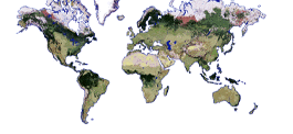
With Google Maps the user can search in millions of addresses and represent the result in a map, satellite or hybrid view.
Depending on the area, the resolution of the satellite imagery is very different. Some regions, especially large cities in the United States and Europe were photographed from airplanes in such a high resolution, that people or details of cars can be seen.
For many other regions only high and medium resolution satellite images are available. Here are buildings and larger residential blocks clearly localized.
Polar regions beyond the 85th latitude are not photographed.
|

|

Aktionskunst in Arles von Aram Bartholl
View Larger Map
|
The advantage of Google Maps over Google Earth is, that you can use Google Maps with a Internet browser (eg Internet Explorer, Firefox, Chrome).
The resolution of the satellite imagery is almost identical in both offerings.
The advantages of Google Earth software are the three-dimensional representation of the world and the additional informations or functionality, that can be linked to the satellite images.
|
|
|
